Lahan (Lahān)
Lahan (लहान) is a city and municipality with 24 wards in Siraha District in the Madhesh Province south-eastern Nepal. It is connected with Mahendra Highway, which is also called the east–west highway. It is located nearly 261 km east of the capital, Kathmandu via B.P. highway and E-W Highway & 424 km east via Narayanghat-Mugling Highway. Lahan is located at the latitude of 26.717 and longitude of 86.483. It is at an elevation of 111 meters above sea level. It follows Nepali time zone, UTC Offset: +05:45 hours.
Laukaha in India and nearby town of Thadi which is 18 km South of Lahan in Nepal are a part of one of the agreed route for Mutual Trade between India and Nepal. Lahan connects Thadi to rest of Nepal. Nepal Government of Nepal has set up a dedicated customs office in the town. and Government of India has set up a Land Customs Station with a Superintendent level officer. So, in simple import and export are allowed in this location.
The population has increased gradually due to urbanisation over a period of 20 years. This city has become a market hub in the eastern part of Province No. 2. Many people come from Udaypur for sales and shopping as well.
The town is popular for Sagarmatha Choudhary Eye Hospital, Lahan a non-profit eye hospital serving residents of Eastern Nepal and neighboring districts of India. Lot of people visit the town for eye and related treatment from Indian border districts of Supaul; Saharsha; Darbhanga and Madhubani via Thadi border.
Map - Lahan (Lahān)
Map


Country - Nepal
 |
 |
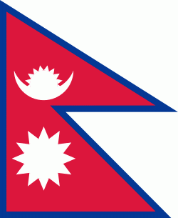
| Flag of Nepal | |
The name "Nepal" is first recorded in texts from the Vedic period of the Indian subcontinent, the era in ancient Nepal when Hinduism was founded, the predominant religion of the country. In the middle of the first millennium BC, Gautama Buddha, the founder of Buddhism, was born in Lumbini in southern Nepal. Parts of northern Nepal were intertwined with the culture of Tibet. The centrally located Kathmandu Valley is intertwined with the culture of Indo-Aryans, and was the seat of the prosperous Newar confederacy known as Nepal Mandala. The Himalayan branch of the ancient Silk Road was dominated by the valley's traders. The cosmopolitan region developed distinct traditional art and architecture. By the 18th century, the Gorkha Kingdom achieved the unification of Nepal. The Shah dynasty established the Kingdom of Nepal and later formed an alliance with the British Empire, under its Rana dynasty of premiers. The country was never colonised but served as a buffer state between Imperial China and British India. Parliamentary democracy was introduced in 1951 but was twice suspended by Nepalese monarchs, in 1960 and 2005. The Nepalese Civil War in the 1990s and early 2000s resulted in the establishment of a secular republic in 2008, ending the world's last Hindu monarchy.
Currency / Language
| ISO | Currency | Symbol | Significant figures |
|---|---|---|---|
| NPR | Nepalese rupee | ₨ | 2 |
| ISO | Language |
|---|---|
| EN | English language |
| NE | Nepali language |